Erosion in the Mara River Basin

Photo credit: Elizabeth Anderson © 2016

Photo credit: Elizabeth Anderson © 2016

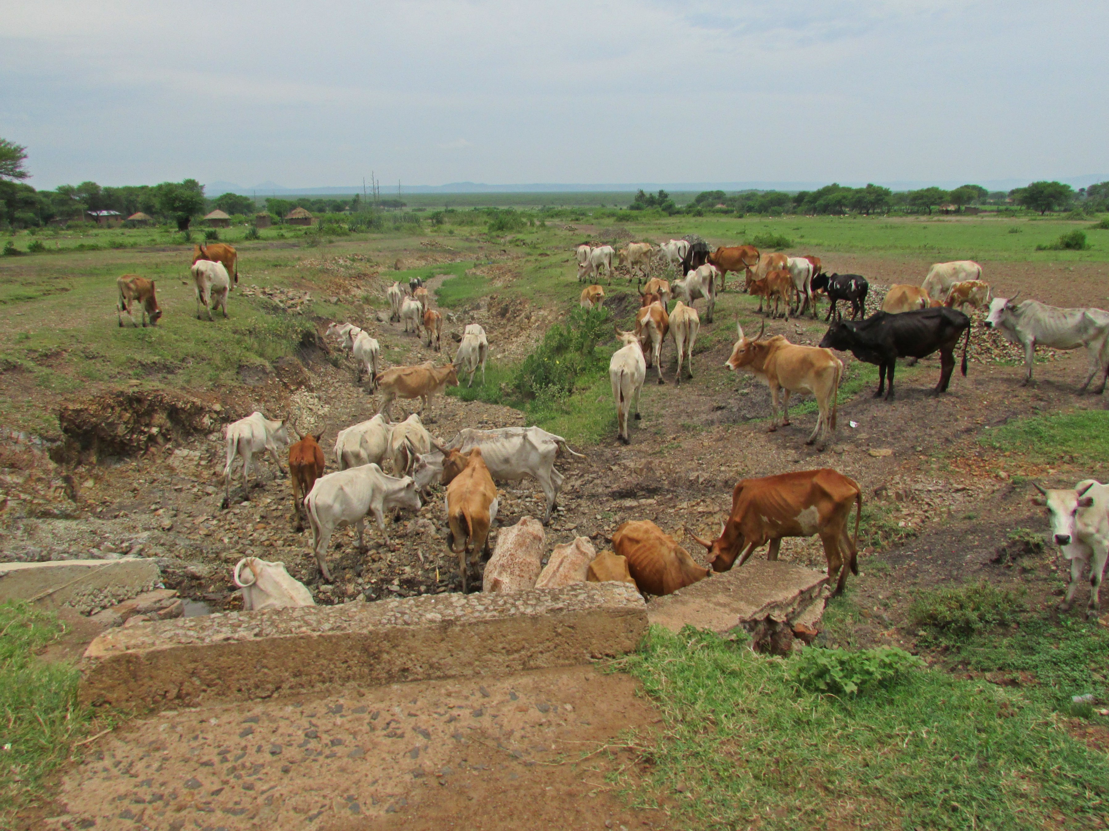
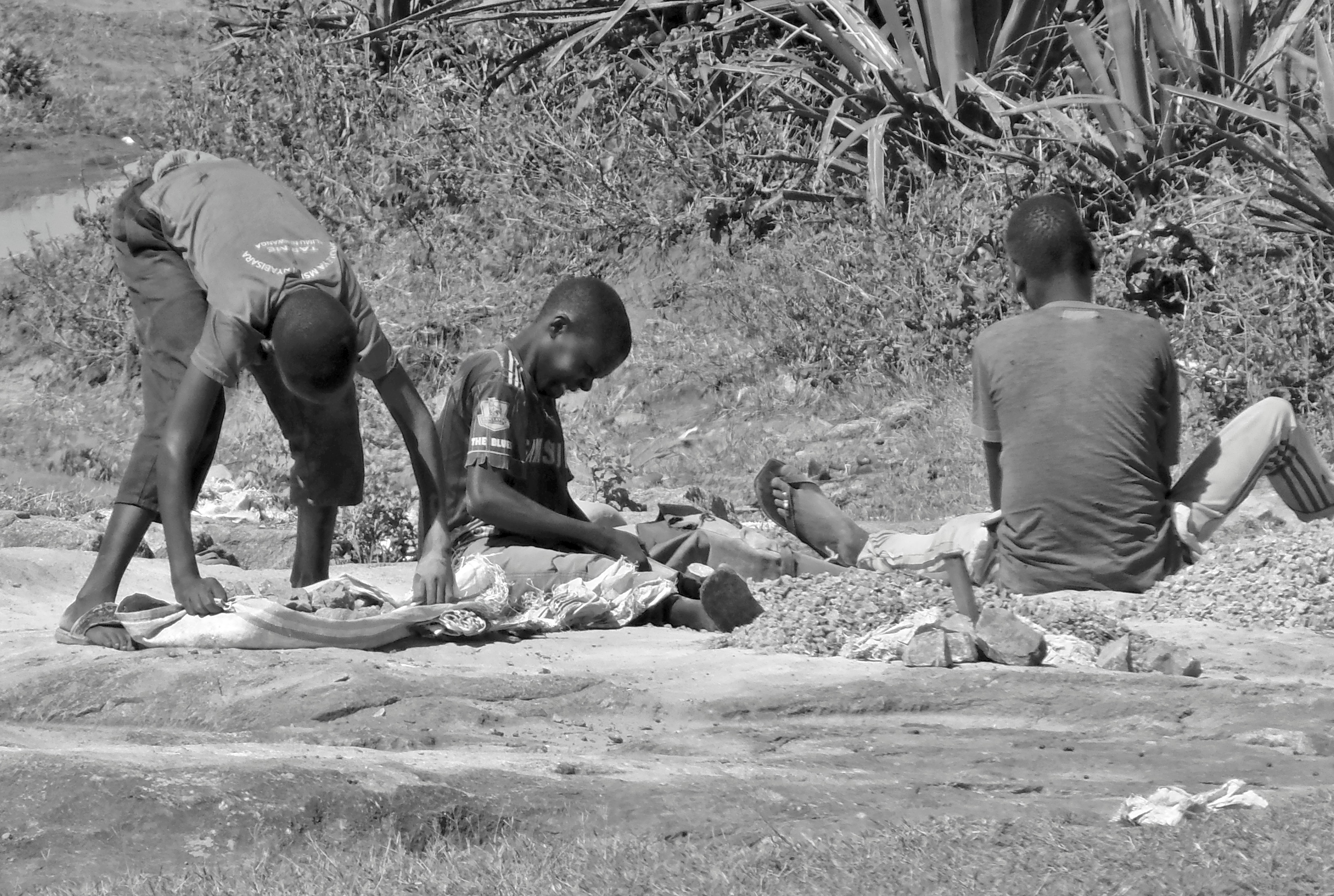
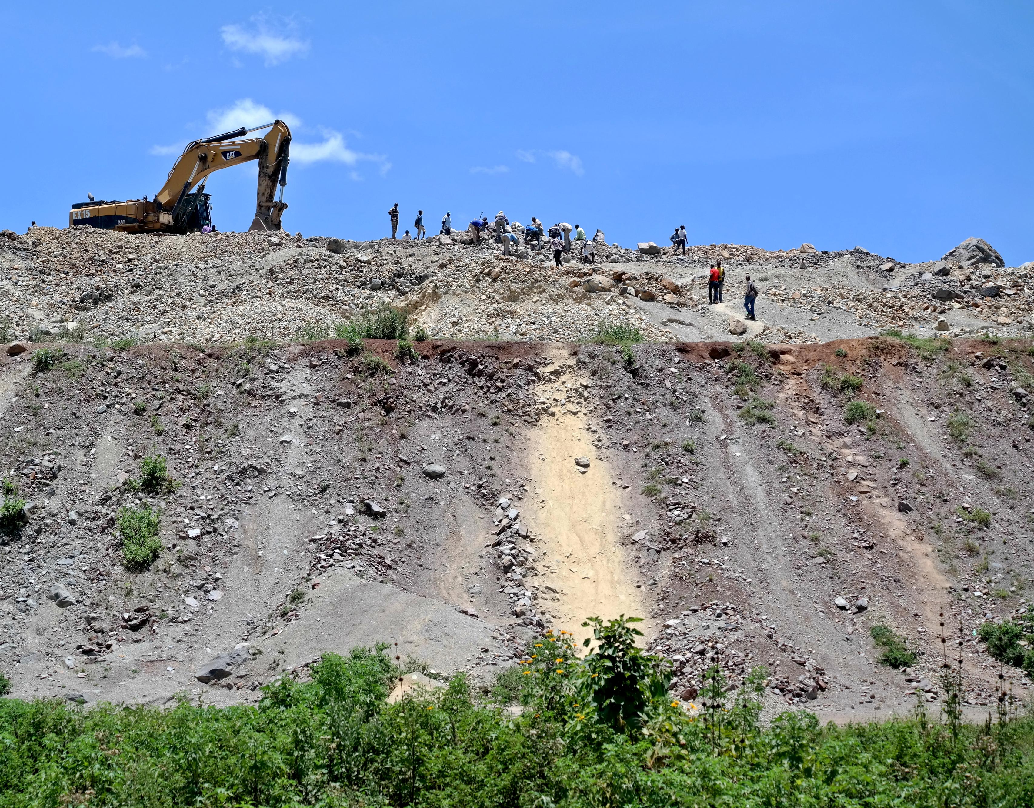
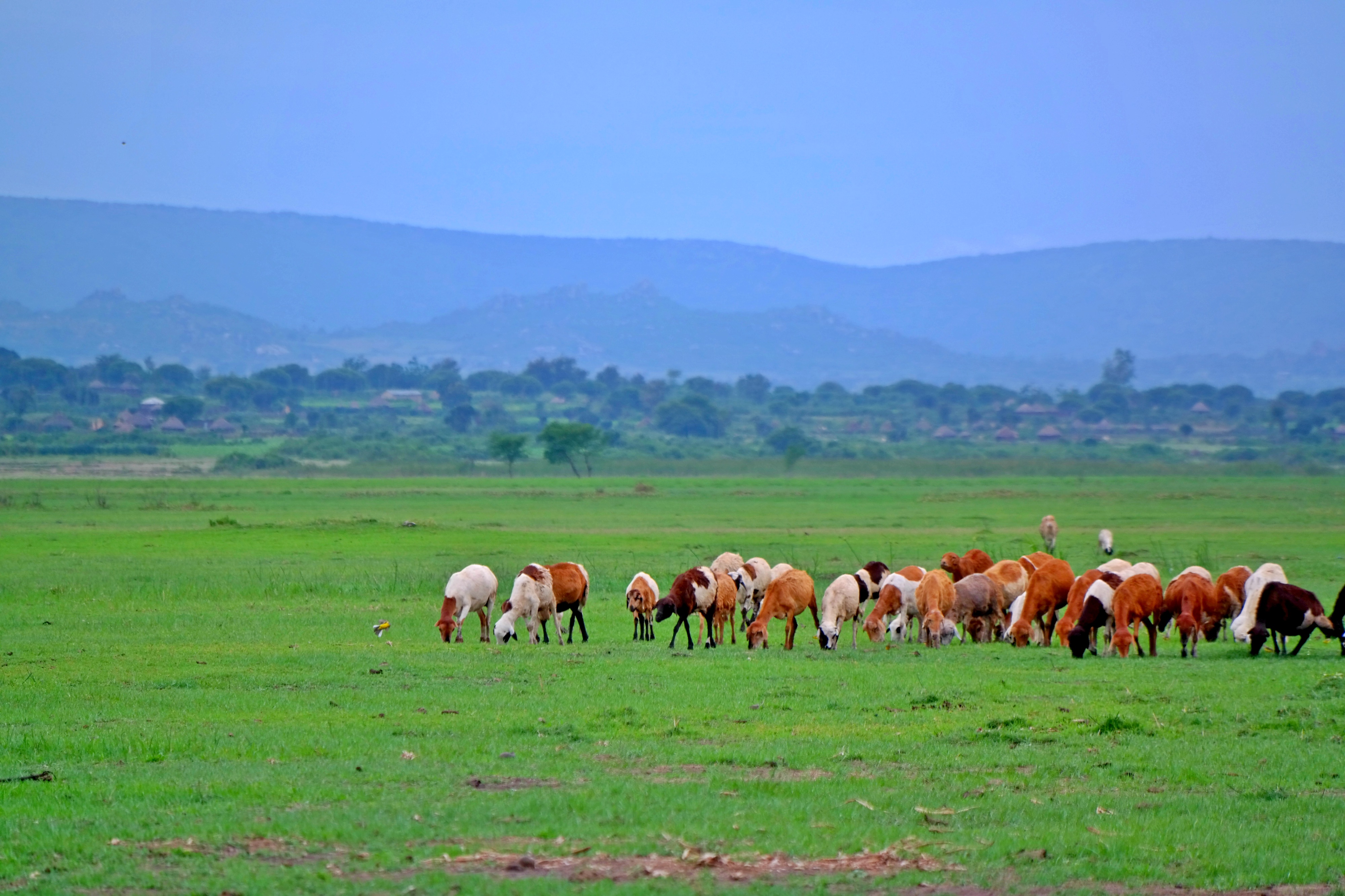
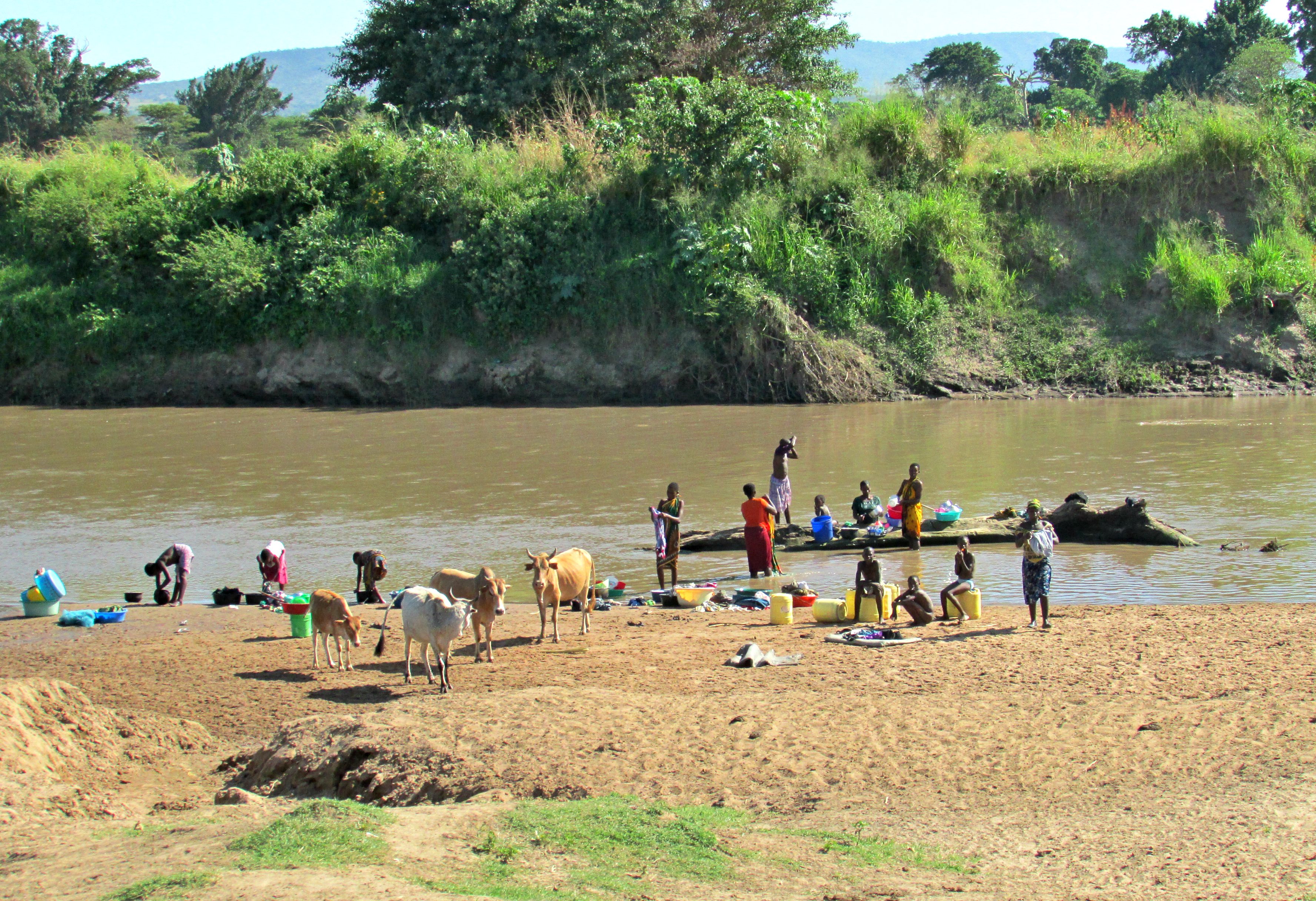
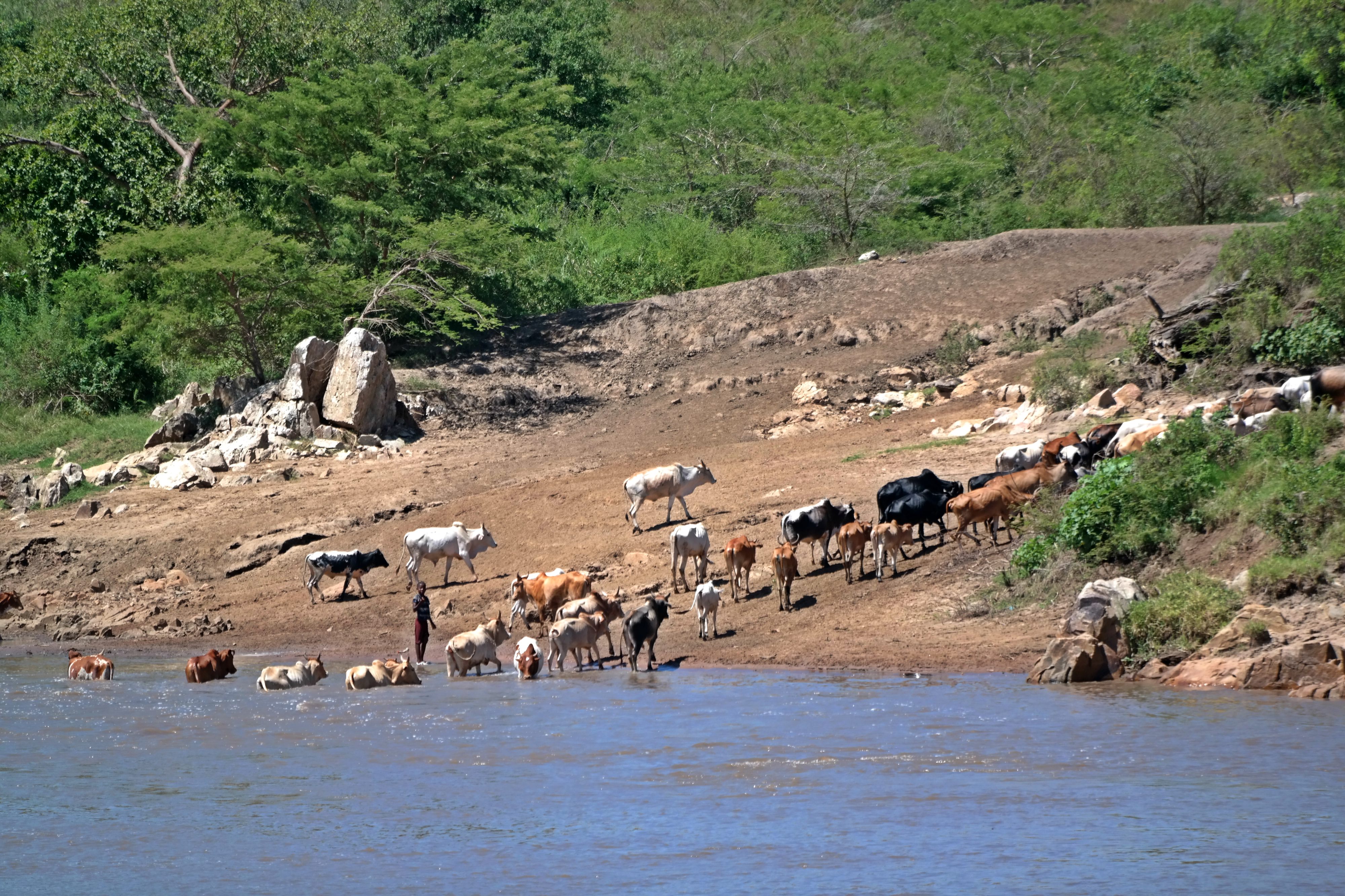
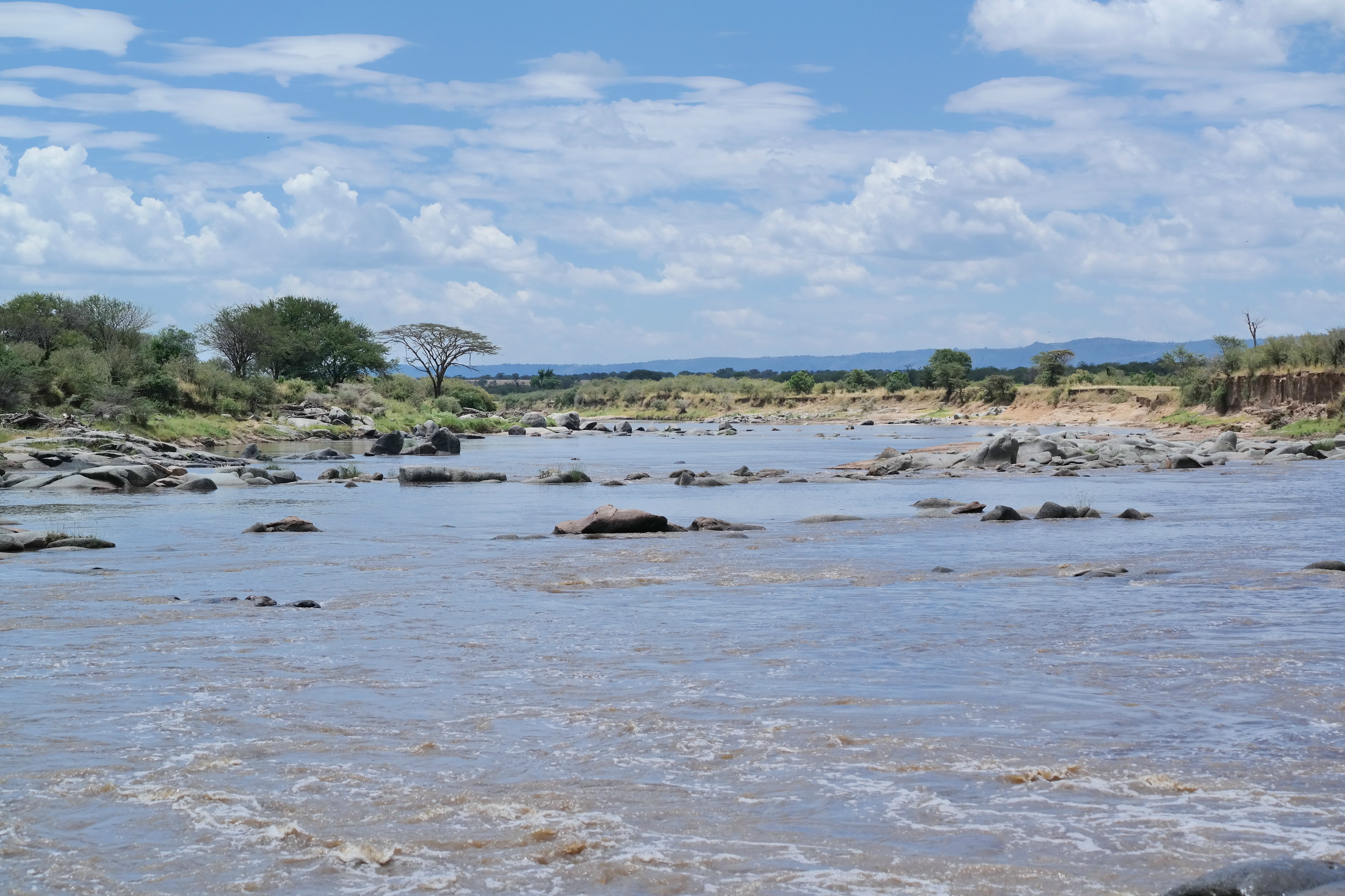
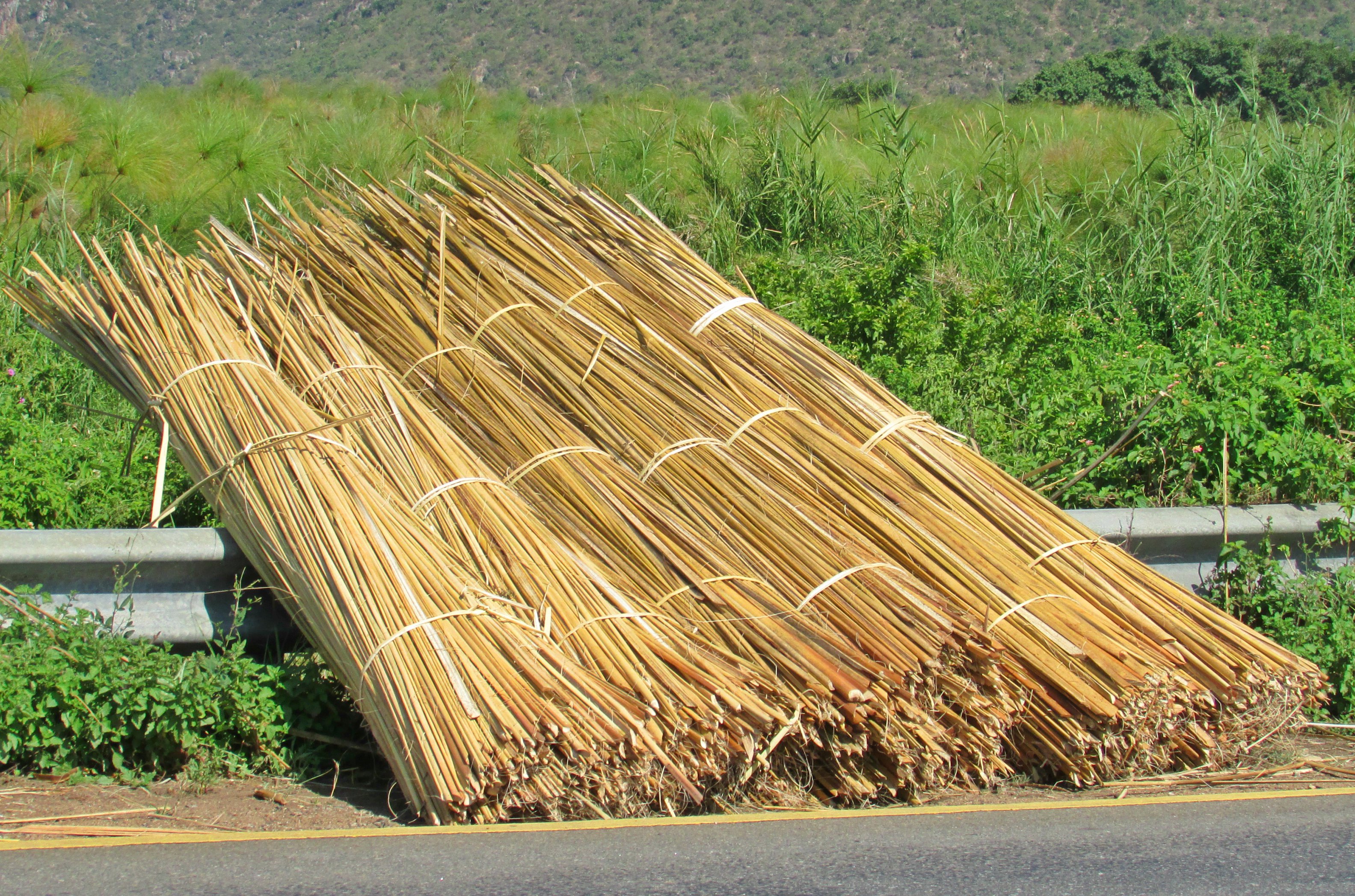
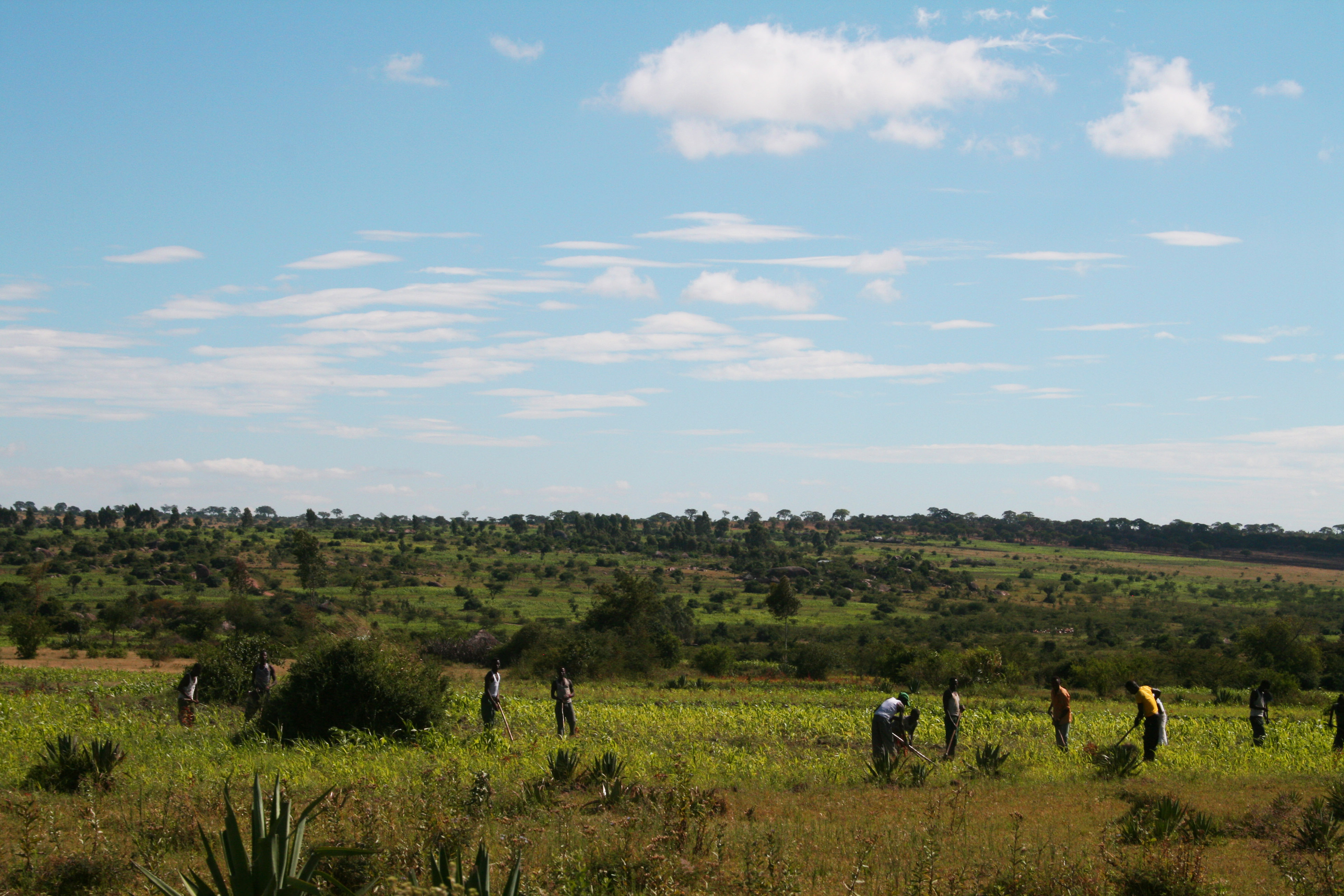
Erosion is a major challenge to the Mara River Basin, as identified by the Lake Victoria Basin Water Offices (LVBWO) in Mwanza. The SELVA team, working with the Tanzanian Ministry of Water in Dar es Salaam and the LVBWO, looked for causes and results of erosion while conducting field work in the lower Mara River Basin in March. Erosion causes a threat to water quality, which in turn threatens the health of people, species of fish and amphibians, the wetlands, and Lake Victoria downstream. Erosion can also alter wetland accretion (or sedimentation) by deposition of sediment in places where water formerly flowed freely. Erosion is caused by exploitation of land along the river and its tributaries due to agriculture, harvesting of timber, moving or watering cattle, cattle grazing, mining, or harvesting riparian (river’s edge) plant species. Erosion is also a natural process and is problematic throughout the African Rift Valley due to the nature of the soils and the big rain events featured during the high rainy season. Our team found that the national policy of keeping 60 meters from the river’s edge was followed in some parts of the Mara Basin, but not in other parts. Where the policy is not enforced, people plant up to the river’s edge and allow their cattle to graze into the wetlands.

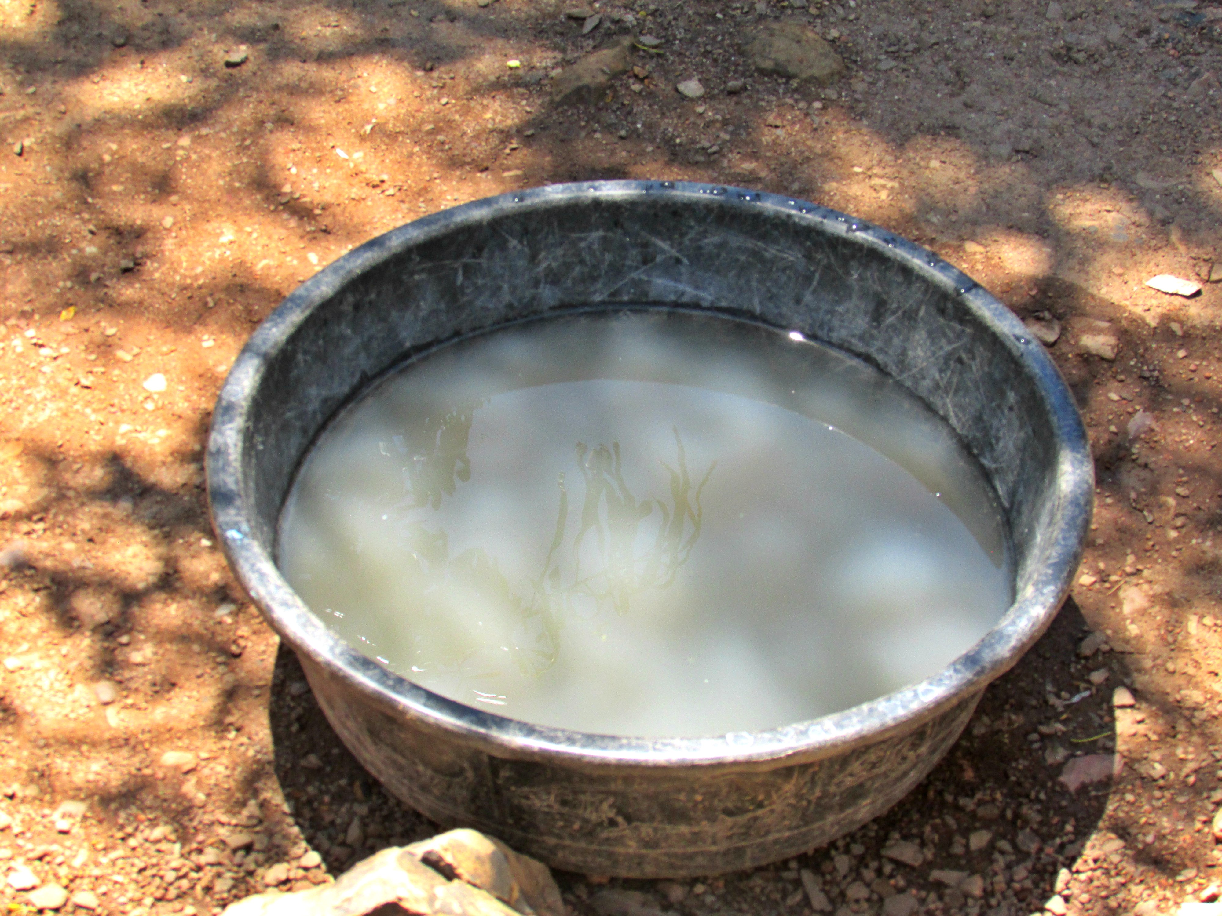
When eroded material enter a river system, it can be carried great distances or deposited fairly quickly depending on, among other things, on how fast the water is moving and how heavy the erosive materials are. Eroded materials are most commonly soils, rocks, sand, and biotic material. In the Mara, eroded materials also carry with them disease from animal and human waste. Locals told our team that incidents of disease occur more frequently during the rainy season because the surface runoff. The Mara River begins at elevation in Kenya and the waters move at a high velocity through the landscape as it descends in elevation. Through the Serengeti Park the waters fluctuate height and velocity in tandem with any rain event, but the water moves fairly well, collecting in some areas to create hippo pools. Once the river has reached the Mara Wetlands on a valley floor in Tanzania, the waters have slowed to almost stillness. It is at the point when the waters slow down that most of the eroded materials it is carrying are released to the floor, or bed, of the river. Chemical bonds are created in this process that either bind, consume, or release eroded material for further movement or to become part of the landscape. In 2015, the regional government officer who went out with our SELVA team-member pointed out the clarity of the Mara River water as it exited the Mara Wetlands (dark but clear) as opposed to further upstream (brown).

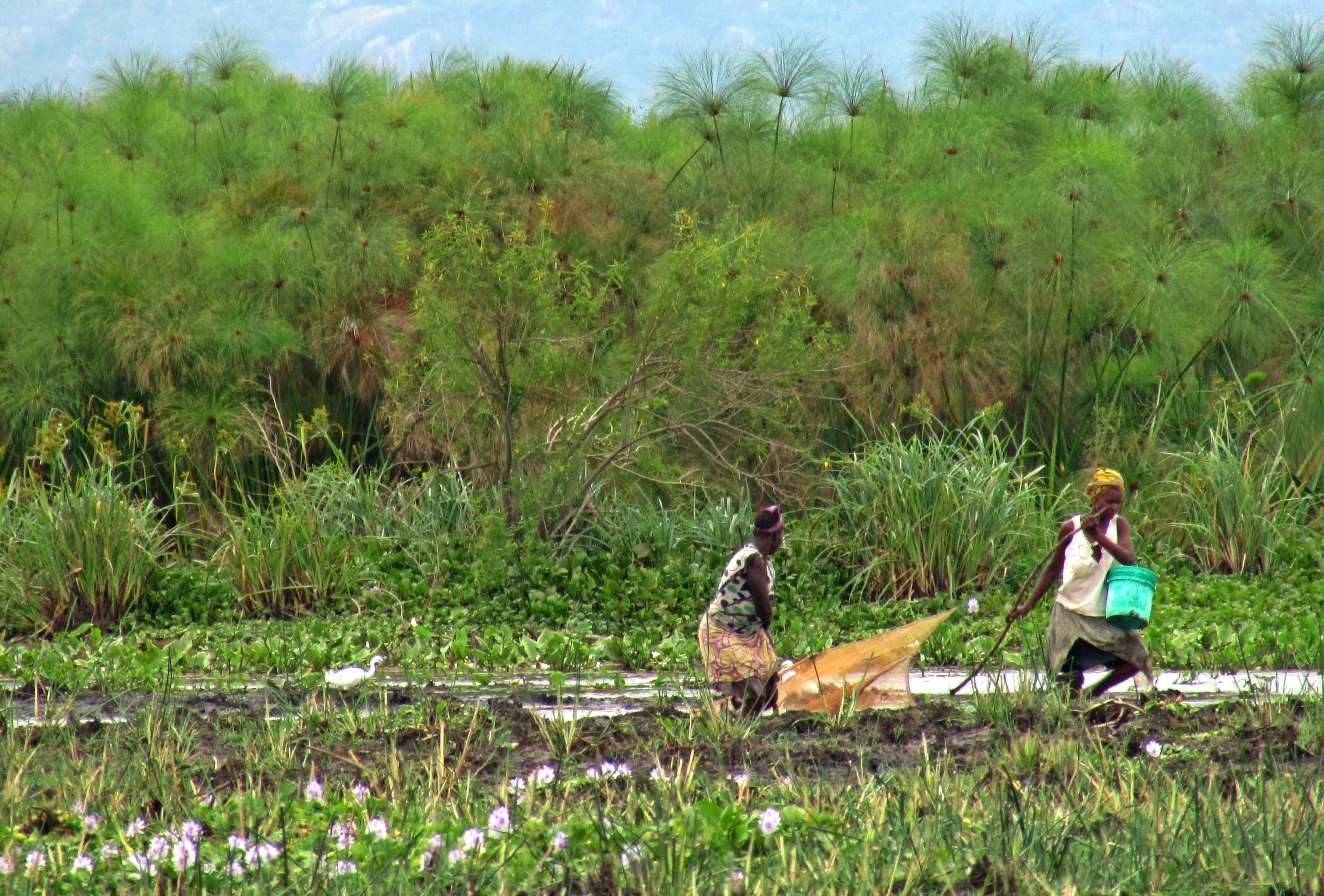
SELVA identified some solutions for soil erosion already practiced in the Mara Basin. Firmer policy enforcement of keeping the 60-meter area adjacent to the river and its tributaries free of agriculture or cattle grazing will encourage local plant life to thrive and the roots will bind the soils in place. Planting more trees along the river can buffer against areas where severe erosion has occurred. Restricting the harvesting of papyrus or other riparian plant species. Additional suggestions may include: identifying areas of specific water access and limiting human impact to those areas, engineering riverbank buffers in areas where erosion is extensive, educating local communities on how to reduce erosion through best practices.

Posted in agriculture, basin management, communities, environment, fish, Lake Victoria, Mara River basin, mining, natural resources, non-river resources, SELVA, sustainable water, water resources

Agriculture in the Lower Mara Basin

Tomato harvesting near Kirume Bridge, Tanzania. Ana Lemos © 2016.

Tomato harvesting near Kirume Bridge, Tanzania.
Ana Lemos © 2016.


The SELVA team observed and discussed agricultural practices with locals throughout the Lower Mara River Basin in Tanzania. We were visiting at the tale end of the dry season (March) and talked with farmers harvesting fruit and vegetables to consume and sell in the market. Locals told us that the crops grow year round and fetch different prices at different times of the year, depending on the food availability in the market. Many locals use manual irrigation practices, hauling buckets of water up from the shores of Lake Victoria, from the Mara River, or one of its seasonal tributaries. Some locals had water pumps hooked up to a diesel generator allowing for water to distribute in a field without hauling the buckets. Women, men, and children were observed in the fields and in some cases the harvesting, planting, or irrigating was accomplished through cooperative efforts of family members or other farmers with adjacent fields.Near North Mara Mines in the Tarime District (discussed in a previous post) was the only exception to locals engaged in farming. This was reportedly due to contamination of the soils from mining activities.  In some communities people help one another in the manual labor, sometimes for money, sometimes in exchange for help in their own fields at a later date.

Agriculture is seasonally driven and practiced by most of the families we spoke to throughout the basin. Different crops are grown depending on the rains – there are four seasons in Tanzania two have rain and two are dry. The SELVA team is in the process of creating a resources calendar that includes these activities. Some people we spoke with practice flood recession agriculture, planting in the nutrient rich soils of the flood plains. This type of agriculture is practiced in much of the world’s river systems, especially in areas where tropical rivers fluctuate greatly with monsoon rains. Maize and sweet potatoes are two of the crops grown in these conditions. Tomatoes and onions are grown in drier soil with the benefit of irrigation. The Tanzanian government prohibits development of the land 60 meters from the river and though in some areas this is enforced, in parts of the basin the SELVA team did not see this in practice. The 60m regulation reduces the amount of erosion and subsequent sedimentation that enters the river during rain events. It also encourages local wildlife and plants to thrive in the riparian zone.

Plans to develop the Mara River Basin from the Nile Equatorial Lakes Subsidiary Action Program locally known as NELSAP (aka World Bank) include irrigation and damming schemes that would impound and divert the river’s flow for storage and irrigation. The plans as described to the SELVA team are to grow cash crops to contribute to the country’s GDP and help with local economies. Due to these upcoming changes on the Mara hydrologic system, some of the current traditional methods of farming may become obsolete. This has been witnessed in other parts of the greater Nile Basin in countries such as Egypt, and the result is that many people are rendered landless and/or loss of access to previously available water and land resources.

Posted in agriculture, basin management, communities, culture, environment, Lake Victoria, Mara River basin, natural resources, non-river resources, Tanzania, water resources, water security

Mining in the Lower Mara River Basin

Mining activity in the Mara River Basin impacts the soil, water, and people. Gold is the most valuable and predominant mining focus and gold mining processes involve toxic chemicals in both the small- and large-scale operations. If you were following the news about the Colorado mining waste spill in 2015 (the Animas River) you are familiar with the health and environmental risks of such chemicals. The SELVA team traveled to the most active mining area in the Lower Mara River Basin, in Tarime District, Tanzania. We interviewed local people about small-scale mining practices, and spoke with officials about some of the education given regarding exposure to the mercury used to “fix” the gold from the sediments and water. We also spoke with locals about the major mining operation that overshadows the village. We saw women, children, and men mining. There were some larger operations where groups of people form collectives, working together. There are also Tanzanian and foreign owned larger mining operations in the valley.

Local boys breaking rocks in preparation of gold processing near Mara River, Tanzania. Jennifer Veilleux © 2016.

Local boys breaking rocks in preparation of gold processing near Mara River, Tanzania. Jennifer Veilleux © 2016.

The North Mara Mine is located very near to the river, and uses river resources for processing. North Mara Mine has various names, is owned by Barrick Gold Coporation – a multinational corporation out of Toronto, Canada and largest gold mining company in the world. The mine and the locals are in continuous conflict over resources, as well as conflict over compensation for land, housing, and water. North Mara Mines has been operating in the area since the 1990s under contract with the Tanzanian government, and provides a percentage of profit to the local district – meant to be reinvested in the local community infrastructure and services. When SELVA traveled to the region, we found the roads in the worst shape we’d experienced in Tanzania, and locals reported that wells sunk by the mining company were not functioning – and there was no recourse available. Locals are left with sourcing their water from the river and tributaries, much of which they say is contaminated with mining waste. Reports of cattle dying or losing babies because of water contamination, periodic releases of acidic mine waste from an enormous holding pond, inability to grow enough food in the contaminated soil, and not having ability to seek any audience with the company were pervasive with locals we spoke with.

Tailing pile from gold mining at North Mara Mines, Tarime District, Tanzania.  Jennifer Veilleux © 2016.

Tailing pile from gold mining at North Mara Mines, Tarime District, Tanzania.
Jennifer Veilleux © 2016.


Posted in communities, environment, gold, Mara River basin, mining, natural resources, non-river resources, SELVA, Tanzania

Mara River Plants and Animals

Sheep grazing near Mara Wetlands. Jennifer Veilleux © 2016

Sheep grazing near Mara Wetlands. Jennifer Veilleux © 2016

Aside from people, many different types of lifeforms rely on the Mara River water resources and the type of ecosystems vary with the landscape throughout the basin. From the dry plains of the Serengeti National Park through the saturated Mara Wetlands to humid shores of Lake Victoria, microclimates and physical geography influence the animals and plants. The SELVA team documented informations from locals about plants and animals they use or see in the landscape. The team collected empirical data on domestic animals including cows and goats and wild animals such as hippos, crocodiles, and made note of a variety of different species of plants, fish, birds, and amphibians.

Giraffe in Serengeti during dry season. Jennifer Veilleux © 2016

Giraffe in Serengeti during dry season. Jennifer Veilleux © 2016

The ecosystems that exist in the Serengeti National Park, a protected ecosystem for East Africa’s iconic wild animals, include lions, elephants, giraffes, gazelle, zebra, hyenas and many other species that either are part of the migrating herds or are permanently in the landscape. The SELVA team traveled in and along the Serengeti for several days and saw lilac breasted rollers, giraffe, Thomson’s gazelle, zebra, Agama lizards in mating season when the males display very bright colors like the image below (these are an invasive species in Florida, USA), hyrax, baboon, dik diks, mongoose, crested cranes, and wildebeest. The Serengeti landscape itself is covered in indigenous shrubs, bushes, grasses, and trees. This ecosystem is very different from the one that exists just outside the park border where agriculture has transformed the land, as written about in an earlier post about the importance of the Mara for the Serengeti Park. Outside of the protection afforded by the park, most of the wild animals and indigenous plants do not appear as prevalently in the landscape, if at all. Areas heavy with human populations are instead replaced with cleared land that supports edible crops, cash crops, and housing. Wild animals are not witnessed as often as domesticated animals.

Agamam lizard in Serengeti Park. Ana Lemos © 2016

Agamam lizard in Serengeti Park. Ana Lemos © 2016

The human landscape has transformed the local resources to support subsistence agriculture, cattle herding, and mining practices. Mono-cropping appears in some places where industrial farms have cleared land for cash crops such as tobacco. Many of the local farms grow a variety of edible crops for subsistence consumption. Much of the area’s natural forest has been cut down for firewood and charcoal production. When an animal, such as a hippo, does venture out of the park, local people tend to kill and eat it. Intense pressure from human activity has created stark divides between areas where wildlife can exist and where it is scarce.

Serengeti Park acacia dominant landscape near to the park boundaries. Jennifer Veilleux © 2016

Serengeti Park acacia dominant landscape near to the park boundaries. Jennifer Veilleux © 2016

Although some of the domestic animals kept by humans are in contrast and even competition with the resources access and equity, the wildlife persists in areas that are protected or uninhabited. Locals told us of a river goat – a species of deer or gazelle that persist along the river in the thick riparian vegetation. A variety of fish and bird species persists in the hard to access expanse of the Mara wetlands. Tanzanian law prohibits use of the land 60 meters approaching the river and prohibits harvesting of riparian vegetation, such as papyrus or reeds. While these laws are not 100% enforced, as the SELVA team saw throughout their field trip, the laws have made a big difference in areas where the laws have been enforced. The policy is thought to help with erosion reduction and it also provides habitat for diverse species to persist.

Learn Swahili language

twiga : giraffe  |  mbuzi : goat  |  ng’ombe : cow |  mti : tree

Posted in agriculture, basin management, communities, culture, ecosystems, environment, fish, Mara River basin, natural resources, SELVA, Serengeti, Tanzania, water resources

Local Importance of the Mara River

Local fisherman checks his traps. Ana Lemos © 2016

Local fisherman checks his traps. Ana Lemos © 2016

The Mara River holds essential important because it is a water resource for local human and ecological communities. As a water resource, the Mara provides year round, albeit inconsistent, flow. The river reflects seasonal flow and level fluctuations due to whether it is the rainy or dry season. People directly use the river locally for livelihoods such as keeping cattle, farming, safari camps, gold mining processing, and fishing as well as for domestic needs that include cooking, bathing, drinking, and washing. Corporations also use the river for mining and farming and this need is increasing as economically-driven development plans are realized throughout the basin. Safari companies rely on the river resources for servicing their clients during tourist season both for domestic needs and as a base for seeing park animals. The great migration of wildebeest crosses the Mara at several locations and ecologists speculate the the animals use the river to navigate the 2000 + kilometer movement. For other species, the water provides a breeding ground, refuge, integral part of their habitat, and drinking water. For Lake Victoria aquatic species, the Mara wetlands, a feature in the Lower Mara River Basin, is a nursery of sorts for fish, amphibians, and birds of all sorts, many of which have not been extensively documented yet.

riverscene

Local access point on the Mara for cattle, bathing, washing, fetching, and fishing. Ana Lemos © 2016.

Identifying other importance of the Mara has been a task that the SELVA team set out to accomplish during their 2016 fieldwork. The team expanded a detailed understanding about the river’s importance by speaking with locals about specific livelihood ties to the river and domestic uses. We also visited the river each day in different stretches to witness the uses firsthand. We ended up with a collection of information that included unique importance based on geography or common importance based on the region.

For humans the river holds more importance than just economic, and for ecological systems, the importance is myriad throughout species’ life cycle. The river signifies the passage of time for when farmers plant and fishermen harvest. The river serves as a central point for social-gathering. In some places one access point is used for bathing, fishing, fetching water, and washing and many people come together and chat over their daily tasks. The river is an ideal place for hunting and spotting African animals on or off the park land. It is also where locals harvest other river-related resources as discussed in an earlier post. Some people use the river for transportation. It is a demarcating device to divide villages and jurisdictions for governance. During a drive across the basin near to the wetlands SELVA experienced the consequences of an overnight rain event that caused ephemeral streams to form and a loud chorus of frog song indicated the awakening of thousands of frogs. Many species need the river and the climate it provides for birthing, breeding, eating, and surviving. And the Mara is one of many important tributaries feeding Lake Victoria with water, nutrients, and species.

The future of the Mara will depend on how these river importances are held in future communities. There is no telling what local or global climate changes will do to the water flow, nor what impending development plans to divert and dam the river will do to the availability or quality of water. Identifying key importances of the river that stretch beyond obvious economic uses is important in current decision-making for future transboundary river management.


Posted in agriculture, communities, culture, ecosystems, environment, fish, Lake Victoria, Mara River basin, natural resources, non-river resources, SELVA, Serengeti, sustainable water, Tanzania, water resources, water security

Water Borne Disease and Human Health in the Mara

Cattle Crossing the Mara River near to the North Mara Gold Mine. Jennifer Veilleux 2016.

Cattle Crossing the Mara River near to the North Mara Gold Mine. Jennifer Veilleux 2016.

The SELVA team traveled throughout the Lower Mara River Basin in Tanzania to collect data from water users about their water access, water quality, and water quantity and encountered chonga moto – Swahili for challenges – related to water and health. Speaking with local people about their water supplies brought up health concerns immediately and this theme of water borne disease continued to feature prominently in interviews throughout the basin. Water borne disease is the most common cause of death in Tanzania. Locals often have no alternative water source to one that is contaminated. Such contamination is due to lack of wastewater treatment, presence of animals and animal waste, contamination or pollutants from upstream sources, mining waste, and mixed use such as bathing and drinking – and some of this is exacerbated by climate change causing warmer temperatures, changes in rainfall patterns and unsustainable development causing further soil erosion and increase of people without infrastructure to handle associated waste.

Health concerns from locals are linked with exposure to water borne disease either their proximity to the water source – such

Bucket of well water in Nyasurura, Tanzania, near to the Mara River. Ana Lemos 2016.

Bucket of well water in Nyasurura, Tanzania, near to the Mara River. Ana Lemos 2016.

as in malaria or yellow fever – or their direct contact with contaminated water – such as in cholera. The diseases locals told the SELVA team about included life-threatening and debilitating conditions. There was an ongoing cholera outbreak in many parts of Tanzania during our field trip in March 2016 that was ongoing from October 2015. Locals spoke of kichocho – Swahili word for schistosomiasis – a disease carried by snails present in the Mara River and Lake Victoria and typhoid a disease spread in food and water.  SELVA documented other complaints of intestinal worms, amoeba, yeast infections, and skin irritations/rashes. Locals stated that many of the diseases are more prevalent during the rainy season when runoff from the villages enters the river and animal carcasses wash downstream from Serengeti Park. Skin irritation was most often reported as linked with algal blooms or mining waste.

The other associated human health risks with local water sources had to do with the dangers associated with fetching the water; a task that women and children are primarily or solely responsible for (see earlier post on risks and water fetching). Worms and other parasites are thought to lurk in the thick mud along the river’s edge; crocodiles and hippos just offshore. Babies are bathed in the contaminated water within days of their birth, and birthing mothers are bathed in the water just before and after birth (local women stated that sometimes this water is boiled). In fact, in some clinics local women must bring their own water to attend births.

Solutions for health risks such as the ones listed above can come from solutions such as improved water sources infrastructure to target waste water gathering and treatment, drinking water treatment, upstream-downstream coordination and management, and waste and water management. Reduction of contamination can be helped through manure control, designated places for washing and animal watering downstream of village drinking water extraction, maintaining the legal 60 meter buffer zone along the riverside, keeping riparian vegetation intact, and continued monitoring of water quality in order to warn any locals of impending outbreaks.

Posted in agriculture, basin management, communities, ecosystems, environment, Lake Victoria, Mara River basin, natural resources, SELVA, Serengeti, sustainable water, Tanzania, water resources, water security

Fishing Lake Victoria and the Mara River

Fishing the Mara Wetlands for cichlids.  Jennifer Veilleux © 2016

Fishing the Mara Wetlands for cichlids.
Jennifer Veilleux © 2016

The SELVA team encountered men, women, and kids fishing every day in the Lower Mara River Basin and on Lake Victoria. Fishing is done with traps, nets, line and hook, and with a local plant-based poison. People fish from boats, from the shore, in the shallow parts of the Mara River, and in the wetlands. Most people we encountered were fishing for home consumption, or subsistence, and sold any excess at the local market. We spoke with men who are part of organized groups of fishermen who camp together in different places along the river and within the lake, fishing for commercial purposes. Fishing constitutes an important part of the local economy and the local diet.

The port in Mussoma is busy with people buying and selling fish fresh from Lake Victoria and officials measuring and weighing fish catchs. Men can be seen hauling fish from Lake Victoria, women can be seen selling fish in the makeshift marketplace or out in the open. Locals come to buy fish for home and trucks come to haul commercial amounts fish to other parts of Tanzania and over the border in Kenya. A popular local fish is the tiny dagaa, a silver cyrinid, which is sold commercially and can be found in piles in the marketplace and along the roadside. Another popular local fish is talapia (or Sato in Swahilit), a type name given to a type of local cichlid, and a familiar affordable fish currently farmed all over the world. The most popular commercial fish is the Nile Perch, locally referred to as Sangara.

Locally important dagaa at fish market in Mussoma.  Jennifer Veilleux © 2016

Locally important dagaa at fish market in Mussoma.
Jennifer Veilleux © 2016

There have been some major changes to the fisheries in Lake Victoria and the Mara River since the 1950s introduction of the Nile Perch, a voracious predator that has decimated local cichlid species. The SELVA team is familiar with the Nile Perch as an example of the adverse impact introduced species has on the Lake Victoria ecosystem, but we found that the fish migrates upstream as reported by locals in the Mara River communities. Most of the local fishers we met reported a decrease in fish catch, decrease in available types of fish, and decrease in overall fish size. While the Nile Perch is commercially valuable, the cost of its introduction is felt in the local fisheries. Benefit of the introduced species has gone to international companies that can afford to send boats out far from shore to haul very large fish from deeper waters. Most local boats do not venture further than 1 or 2 km from shore, while few local sailboats will travel many kilometers further out in Lake Victoria to fish. The movie Darwin’s Nightmare tells local stories from locals living on and around Lake Victoria related to the commercial trade in Nile Perch with Europe. Impacts include things such as deforestation, overfishing, loss of species, pollution, and disease.

Lake Victoria cichlid catch.  Elizabeth Anderson © 2016

Lake Victoria cichlid catch.
Elizabeth Anderson © 2016

Locals reported changes beyond what the Nile Perch introduced, changes to the catch of Nile Perch itself and the water. The local officials who monitor catches reported that there are fewer Nile Perch caught and of the ones caught, the size is smaller. Some of this, they told the SELVA team, has to do with overfishing, fishing juveniles, and changes to the water itself. The water in Lake Victoria carries floating islands of water hyacinth and there is a government campaign to eradicate the plant species through removal. There are daily periods of algal blooms in the morning and afternoon turning the water green. When there are more algal blooms in the lake, there are less fish, the locals report. The locals in Lake Victoria also report an increased water level in the last 20 years. Locals in the Mara River shared their observations of change in the Mara Wetlands as an increase in papyrus plants and extent of the wetlands, and increase of the water level taking over farmland. These changes are related to the fish spawning grounds, fishing access, and catch availability. The SELVA team documented many stories from local fishers about the types of fish they are catching, the changes, and the importance of fish to their diets and livelihoods.

Locally prepared tilapia. Delicious! Ana Lemos © 2016

Locally prepared tilapia meal. Delicious!
Ana Lemos © 2016

Posted in basin management, communities, ecosystems, environment, fish, Lake Victoria, Mara River basin, natural resources, SELVA, Tanzania, water security

Mara River and Serengeti National Park

Stretch of the Mara River in Serengeti National Park, Tanzania © Jennifer Veilleux 2016

Stretch of the Mara River in Serengeti National Park, Tanzania © Jennifer Veilleux 2016

The Mara River is an important feature for both the Maasai Mara Natural Reserve and Serengeti National Park, integral conservation zones for some of East Africa’s remaining iconic species. The Lower Mara River snakes its way through the north and west of Serengeti National Park in Tanzania before making its way across a human landscape to enter Lake Victoria at Musoma town. The Mara’s importance to the Serengeti is multiple: the river is a year-round, or perennial, source of water for the Serengeti’s ecosystems, contributes to the local climate, is a key geographic feature for the semi-annual wildebeest migration (the animals are known to cross the river several times), and the river’s related ground water serves some of the safari camps. The SELVA team traveled to the Park during their field investigation to speak with park officials, safari camp operators, and site a new location for hydrologic data collection devices set to deploy later this summer.

The former Serengeti National Park chief ecologist, Emilian Kihwele, and safari camp operators indicate that the Mara River is important in locating park animals for tourists and research scientists, as well as for the great semi-annual migration. The river serves as a likely spot from which to view the dramatic migration that sometimes demonstrates predation of wildebeest, zebra, or gazelle by Nile crocodiles.

Downstream water security issues for local residents are tied to the Serengeti ecosystems. Local residents near in Nyasurula told stories of bloated bodies of animals found during the rainy season in the same areas where they source drinking water. Sometimes dangerous animals, such as hippos, come out of the Park and this may endanger women and children who are at the river for washing or hauling water.

Posted in ecosystems, environment, Mara River basin, natural resources, Serengeti, Tanzania, water resources, water security

River Resources Beyond Water

reeds

Harvested reeds from Mara River shoreline photo credit Ana Lemos 2016.

People living along rivers use more than just the water for livelihoods around the world. In the Lower Mara River Basin, people fish, harvest plants and trees, hunt, and mine. The SELVA team identified these resources that are termed non-river resources. Building materials are particularly important as many local houses are mainly made from mud, dried reeds, and wood. Plant material is also used to weave baskets and make traps for fish. Sand and stones are also mined for building material.

Nutrient-rich soils along the river shore are used for farming and grazing, but there is a Tanzanian water law that prohibits use within 60 meters of the river. Fish are fished from the wetlands and river by both men and women. Wild animals that live along the river are hunted and eaten, including hippos when available. Gold is mined from an area on the north shore of the Mara River by an international corporation, domestic companies, and local artisanal miners. Trees are harvested for charcoal production, especially in the Serengeti District.

All of these river-related activities impact water quality and the health of the ecosystem The SELVA team is documenting these types of livelihoods to identify possible opportunities for management and conservation.

Posted in agriculture, communities, ecosystems, environment, Mara River basin, natural resources, non-river resources, SELVA, Tanzania

Contrasted Landscape Between Local Agricultural Areas and Conservation Areas

Locals cultivate food along the Serengeti Park Fort Ikoma Gate. © Elizabeth Anderson 2016

Locals cultivate food along the Serengeti Park Fort Ikoma Gate. © Elizabeth Anderson 2016

Conservation efforts for critical ecosystems around the world are continually threatened by human pressure, and Serengeti National Park (NP) manages resources conflict along its borders with locals. The SELVA team recently traveled around and in the Serengeti National Park where it falls within Mara River Basin and we witnessed active cultivation near to the Fort Tikoma and Tabora B entrances. Before traveling into the field, our team examined satellite imagery of the park boundaries and found tracks from local settlements into the park. Recent news stories report regional drought conditions causing increased illegal grazing of local livestock, locals illegal harvesting charcoal, and the perennial controversy of the Maasai access to ancestral and religious landscapes. Resources demand of conservation land for a range of critical species needs and land necessary for local resources needs requires complex mediation strategies between the people, the park, and the government. The SELVA team collected information from the park guards, local communities, and businesses inside of the Serengeti NP to better understand this situation.

The contrast between land inside the park boundary and the local landscape outside is remarkably different. The area is situated along the Tanzanian border with Kenya where the semi-annual great land migration of more than one million wildebeest, zebra, and gazelle takes place, and is one part of a contiguous landscape of restricted land for conservation which attracts tourists with cameras and guns. Just outside of the park boundaries, the entire landscape is different and the footprint of generations of local people cultivating and grazing is evident: forested areas have made way for fields and local infrastructure, remaining forests are under pressure from charcoal harvesting, tobacco farms, and resulting land erosion is visible throughout the Lower Mara River Basin as a result.

Conflict with locals over land, timber, and animal resources is an ongoing management issue not limited to Serengeti, but occurs in many parts of the world. These conflicts will only increase over time as climate change and land and water resources development couple to shift regional and global hydrological cycles, seasonal temperatures, and the predictability of these environmental aspects integral for subsistence agricultural communities.

Posted in agriculture, basin management, communities, ecosystems, environment, Mara River basin, SELVA, Serengeti, Tanzania, water resources