

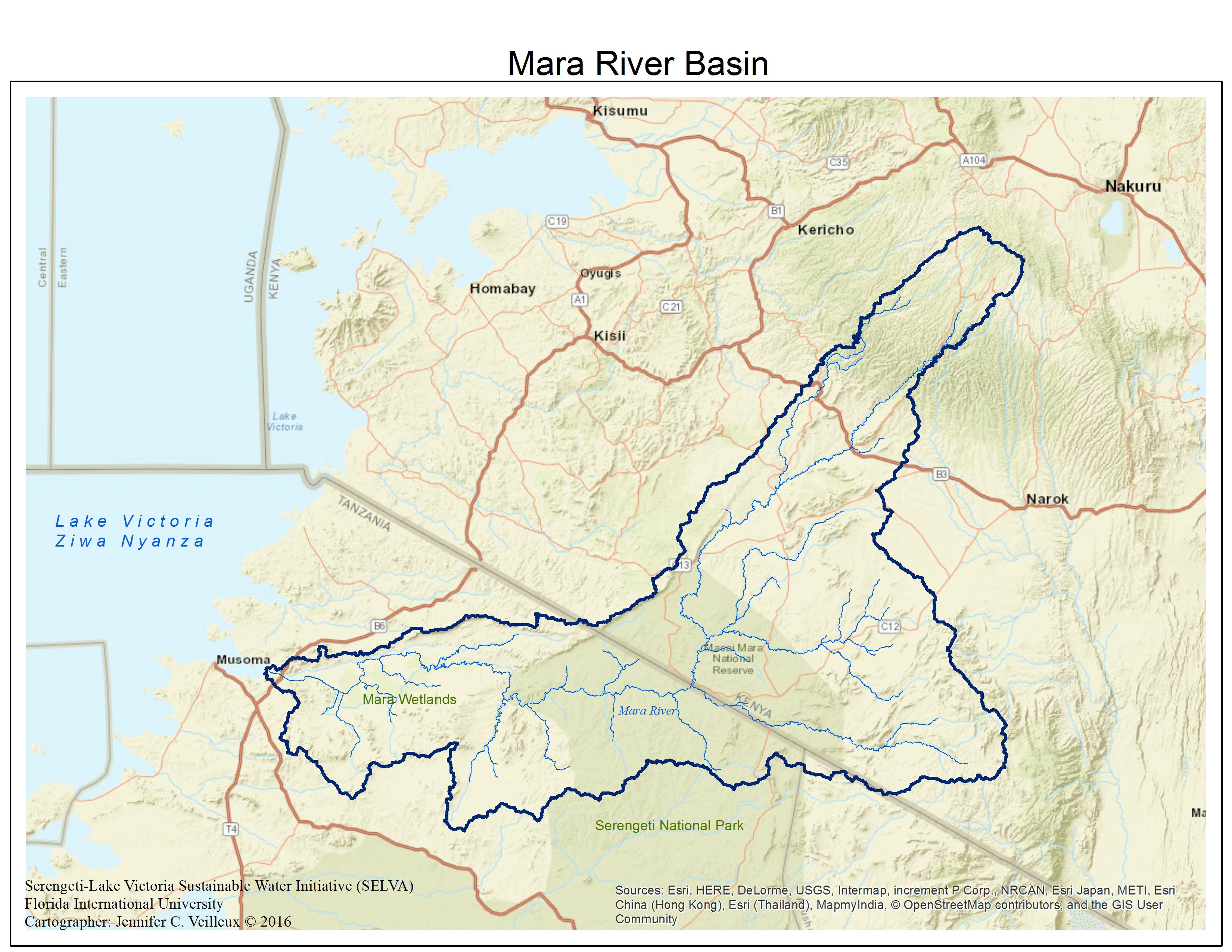
The Mara River basin is shared between Kenya and Tanzania, and home to approximately 1.3 million people. The Mara’s headwaters originate in the Mau Forest of Kenya and the river terminates in Lake Victoria. Approximately 65% of the basin is found in Kenya and the remaining 35% is found in Tanzania. Between the Mau Forest and Lake Victoria, the Mara flows through the protected areas of Maasai Mara Nature Reserve and the Serengeti National Park, both of which make up the famous Serengeti-Mara system, home to the largest land animal migration on Earth. SELVA’s focus is the lower Mara Basin, the area found within Tanzania. This includes the protected area of Serengeti National Park, several communities and settlements in the area between the park and Lake Victoria, including a protected wetlands complex as well as international industry, local agriculture, tourism, and local fishing.
The Mara is a sub-basin of the greater Nile River Basin and is one of the only perennial rivers in the Mara-Serengeti region. The river is currently under threat from regional climate change and human engineered river alterations for water development projects. The human and ecological communities dependent on the river are in turn vulnerable to changes in this vital water resource. SELVA hopes to capture the strengths and weaknesses of this complex system through our project efforts. You will find some of those descriptions in the following collections.
Mara River Basin Digital Documents Collection with Florida International University Library
The Mara River Basin Collection provides access to social and ecological information in the form of scholarship, white papers, official documents, images, maps, reports, datasets, and images as related to the geographic area within and adjacent to the Mara River Basin, East Africa. This collection includes historic and current information. The collection can be accessed at: http://dpanther.fiu.edu/dPanther/collections/Mara
The initial collection is a collaboration with MaMaSe and SELVA. The result is a searchable document database of Mara River Basin-related water security topics. If you have any contributions to this database, please contact us directly:mara@fiu.edu.
The following link connects to an open source collection of geospatial data developed and deployed by MaMaSe and contributed to by SELVA:
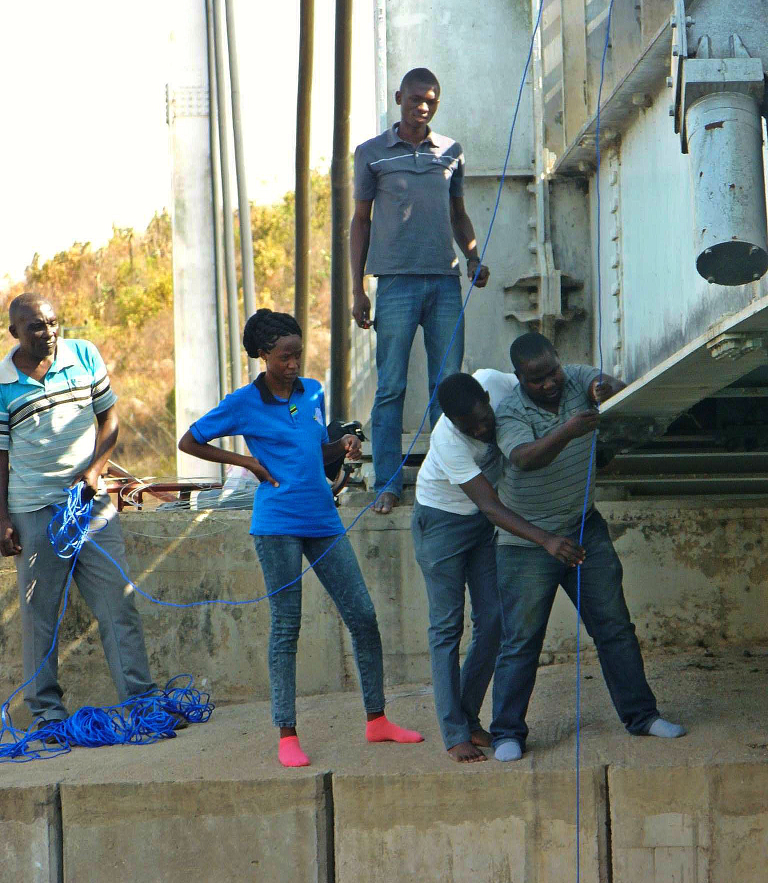
SELVA will be deploying low-cost monitoring devices throughout the Lower Mara River Basin in 2016. Click here for images of our field team installing the devices along the Mara River. We have eight installations and are beginning to generate real time data.
The live flow and weather data is coming soon!
SELVA team member Dr. Jennifer Veilleux, captured portraits of stakeholders in the lower Mara River Basin, Tanzania during two field trips to the basin. She has curated the collection as a subseries on the Mara River within her ongoing work: Portraits from Rivers of Change.

Children cross bridge over the Mara River © Jennifer Veilleux
COMING SOON!


